 |
Dates |
April to October |
| Duration | 17 days | |
| Grade | 1A/2A | |
|
"Andes" Leadership Fee
(includes leaders expenses) about £2500 |
||
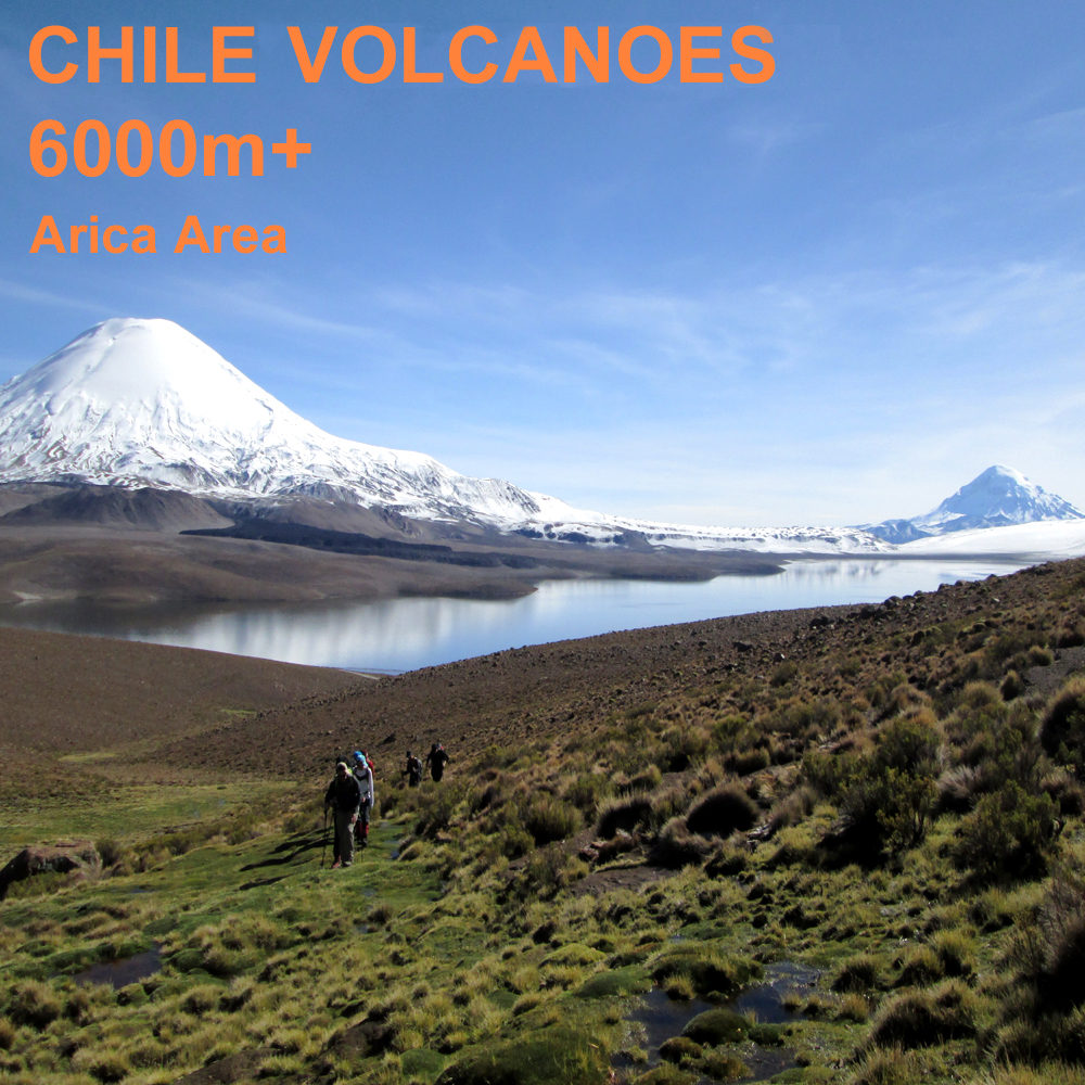
Easy High Altitude Ascents in Northern Chile.
PRICES & COSTS
All are per person.
"Andes" Leadership Fee (includes leaders expenses) -- about £2500
Estimated Airfares from the UK -- £1500
Estimated Travel Costs in Chile -- £500
Estimated Accommodation & Meals -- £300
ESTIMATED TOTAL COST per person -- £4800
What's included in the price you pay ANDES and what's not.
INTRODUCTION
Outline Itinerary |
|
| Days 1-2 | Flights to Santiago and onwards to Arica |
| Day 3 | Preparation in Arica and/or Putre (depends on flight schedules) |
| Days 4-7 | Acclimatisation around Parinacota, including ascents of Guaneguane (5097m) and Choquelimpie (5298m). Mix of Putre hotel and our first camps. |
| Days 7-8 | Overnight in hotel, then drive to Volcan Guallatiri base camp, rest and prepare. |
| Days 9-13 | Ascents of Acotango (6052m) and Volcan Guallatiri (6063m). We may also have time to climb Capurata (5996m) |
| Day 14 | Travel back to Arica, with time for an afternoon swim in the Pacific. |
| Days 15-17 | Fly home via Santiago, very likely with an overnight there. |
General Information about our holidays
Please read our warning on altitude before booking this expedition to high altitudes.
Who runs 'Andes' and where we are based
General information about equipment, accommodation, flights, meals etc.
ARICA AND PUTRE
The expedition will fly out to the coastal city of Arica in the extreme north of Chile via the capital Santiago. It's a biggish city just 20 miles or so from Peru. There is a long beach front, popular with Chileans from Santiago during the southern hemisphere summer months. We'll likely have an overnight here at the beginning and again at the end of the expedition, although this will depend on flight schedules when we all book flights. From Arica we will first travel to the mountain town of Putre at an altitude of 3500m, where we will spend two overnights acclimatising to the altitude. Putre is about 3 hours drive on a good asphalted road from Arica.

The wee town of Putre and the Nevados de Putre, photo taken on our first visit there by bike in 1991.
ACCLIMATISATION TRIP
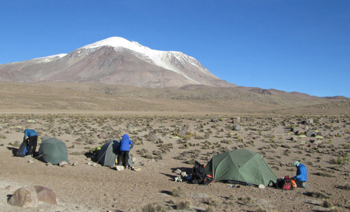
As we've done before on this itinerary we'll first do a two night camp and make some acclimatisation ascents. These will be of hills in the range of 4800-5200m, possibly climbing as high as Cerro Choquelimpie, a 5298m high hill. (Ascent pictured in the title box at top of the page). During this spell we will be camped beside the very scenic Laguna Chungara at an altitude of about 4500m. As with the main peaks, the camping is all vehicle based (or at least very close) so no backpacking is required on this expedition.
Volcan Guallatiri from the north. Our route is roughly by the left hand skyline.
VOLCAN GUALLATIRI
The 6063m high Volcan Guallatiri is an active volcano very near the Chile-Bolivia border, but entirely in Chile. It is one of the more active volcanoes in this part of the Andes. We'll climb it by the northeast slopes, over snow and ice, from a high road end at about 5200m that we will reach with our 4x4 vehicles. This ascent usually takes about 6 to 8 hours, but with a much quicker descent. We usually camp a bit below the end of the road at an altitude of about 5000m. For more information about Volcan Guallatiri and fotos click here.
VOLCAN ACOTANGO & CAPURATA
Acotango is a 6052m high extinct volcano on the Chile-Bolivia frontier. We'll climb form the end of a track at 5000m in one day. The ascent is largely on snowfields on the SW or west side of the peak (depending on the year and the snow conditions). For more information about Volcan Acotango and fotos click here.
If time allows and people are feeling fit we may well also climb the peak of Capurata. At 5996m Capurata is one of the highest peaks in the Andes that does not reach 6000m!. It is a nice scenic ascent by the long north ridge.
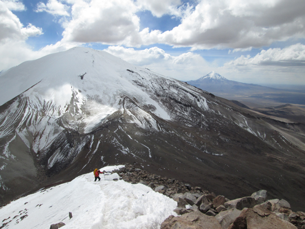
Acotango as seen from high up on the descent of the north ridge of Capurata. The distant peak on the right is Nevado Sajama, the highest mountain in Bolivia.
FITNESS & EXPERIENCE NEEDED
Although there is no difficult climbing involved in the ascents planned on this expedition clients need to have some previous experience of using an ice-axe and crampons.
Climbing to such heights is always a serious matter because of the lack of oxygen at high altitude. For this expedition good mountain fitness and stamina are important, but for high altitude expeditions clients also need good cardiopulmonary (heart and lung) fitness. This can only be maintained, by a program of intensive exercise such as sprinting (not jogging), squash or sprint cycling. This should be done in small doses (e.g. an hour every other day) over a period of at least two months.
Clients should be prepared for cold nights camping and be prepared for windy and dusty weather at times out in the mountains. As we'll be a long drive from the nearest supermarket we will have to put up with some tinned and freeze-dried food in our diet during our time in the mountains. All clients are expected to help a little with the routine work of this type of expedition; pitching tents, cooking and washing up
CLIMATE
The climate at altitude in the northern Chilean Andes is very cold and extremely dry. In the mountains temperatures can fall to -10ºC at night. During the day in the mountains it can feel very warm in the strong sun, but it can also be bitterly cold and windy. It may be dry all the time we are in South America, but there is quite a high chance of a snow flurry, or occasional afternoon thunderstorm in the mountains. As we are near the tropics come prepared for about 10 hours of darkness every night. Temperatures in the valleys and around Arica and in other low lying areas will be a very pleasant 20-25ºC during the day.
ORGANISATION & LEADERSHIP
Our expeditions are designed to be small and flexible. The expedition will be co-ordinated, organised and lead by us, but we will consult and involve the expedition members when planning the day-to-day details of the trip. Please note however that the leaders decision is final where the safety of the group or any member is in jeopardy; for example where retreat or diversion is necessary due to illness or bad weather.
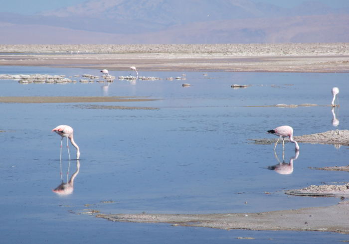
Flamingoes on the Laguna Chungara.
INSURANCE, HEALTH & SECURITY
All clients must be insured for medical costs and repatriation in an emergency. We recommend having insurance for baggage, personal liability and cancellation as well. If you would like further advice please ask. Chile is a well developed country. Vaccinations for tetanus, typhoid and polio are recommended. The country is very safe and relaxing to travel in; theft and muggings are no more likely than they are in most of Britain or Europe.
SAFETY AND RISK
This is an adventure holiday and all
clients will be exposed to hazards not found in
everyday life by taking part in this itinerary. While we take all
reasonable precautions to reduce risk it is neither possible nor desirable
to completely eliminate these hazards. It is important that you understand
the hazards you may be exposed to before
signing our booking form. We have identified the following areas as the
principal additional risks of this itinerary. (Some of
these could potentially result in serious injury or death). This is
not a fully inclusive list - a more detailed risk assessment of this itinerary
is available on our
Risk Assessments page, or phone/e-mail us
and ask some questions!
Driving, hotels and general
safety : In Chile the driving, fire standards and general safety standards are
not quite as high as in Europe, although they are now very good
Extreme remoteness : You will be
camping in a remote area for several nights and therefore obtaining
medical assistance for any problem will be a slow process, taking many hours.
There is no chance of a helicopter rescue.
Minor slips and falls : due to
steep, uneven and unstable ground.
Weather : This area is
occasionally affected by severe and sometimes dangerous storms, including
thunderstorms. There are sometimes high
winds. Forecasts are
not so reliable.
Altitude : At high altitudes there is an increased risk of
medical problems, most obviously altitude illness.
Mountain Hazards : In certain places you may be subjected to a slight risk
of rock fall, or slip on icy terrain or steep snow. Guallatiri is an active
volcano and so you will be exposed to a very low level of risk from any
unexpected increase in volcanic activity.