
Peru
Without a doubt Peru offers the best and most varied trekking in the Andes. Whilst the mountains are just as spectacular in Patagonia, the cultural experience is far less interesting and you don't have the challenge (or thrill) of being at high altitude. Furthermore Peru is one of the cheaper destinations in South America - a flight to Lima can cost as little as £600 in the low season and living scosts are not high.
The Cordillera Blanca
The Cordillera Blanca range in northern Peru has an incredible concentration of 6000m peaks, including Peru's highest mountain, the twin peaked Nevado Huascarán 6746m. The Cordillera Blanca mountains run roughly north to south and are easily accessible from the heavily populated Callejon de Huaylas valley which lies to their west. The friendly wee town of Huaraz, at an altitude of 3000m, makes a great base. It is 500km north of Lima by a good road and there are also daily flights from Lima. The town has many pleasant hotels and restaurants, plenty of tourist and trekking agencies and spectacular views of the mountains at sunset. Access from Huaraz to the mountains is generally very easy; most trail heads can be reached in only a couple of hours by public transport.
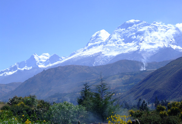
Huascaran and Huandoy seen from near Huaraz, Cordillera Blanca.
Lying between the peaks of the Cordillera Blanca are valleys dusted with stunning turquoise glacial lakes. These run mostly west to east. Most treks follow these valleys through the mountains and will take from 3-5 days, but two valleys can often be linked to provide longer excursions. If finishing on the eastern side of the range be aware that it is much more remote and you may take you a few days to get back to Huaraz after your trek.
The most famous trek from Llanganuco to Santa Cruz is now a bit shorter due to the opening of a new road over the mountains, but what is left is still very worthwhile. This trek now takes three to four days from Vaqueria on the eastern side of the range to Cashapampa north of Huaraz, via the 4750m high Punta Union pass. There are superb views of some of the Cordillera Blanca's most spectacular mountains such as Chacraraju, Alpamayo and Artesonraju. You'll still see the beautiful green Llanganuco lakes on the drive to Vaqueria and it's worth at least a short stop to admire them.
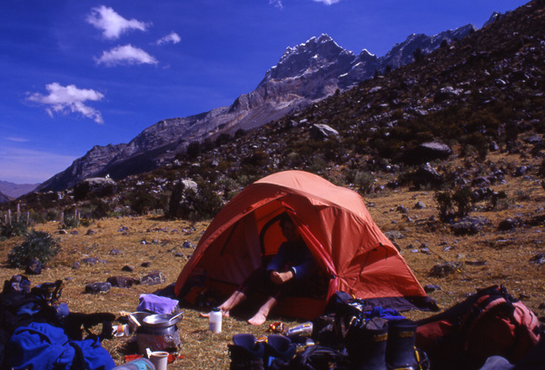
Campsite in the remote Quebrada Rurec near the Olleros to Chavin trek.
Further south there are several trekking options around the Copa massif. You can trek through the mountains to the town of Chacas by either the Ulta or Honda valleys in four days, or do the full circuit in about eight days. Both valleys are very deep and have passes of about 4700m at their heads.
In the southern part of the range another well known trek is the three day trip from Olleros to Chavin via the 4700m Punta Yanashallash pass which ends at the village of Chavin. In this village are the extensive pre-Inca ruins of Chavin de Huantar, unusual in that they are basically a network of tunnels. Be sure to bring a torch because there is very little to see on the surface.
From Huaraz a number of other activities can be organised including snowboarding and skiing at Nevado Pastoruri. The drawback with the skiing is that there is no tow so you have to carry your skis up and down the piste, but this doesn't deter hundreds of well off Peruvians from giving it a go. If you fancy climbing one of the challenging peaks of the Cordillera Blanca you can also find a guide here - the most popular peak with trekkers is Pisco 5752m, which has a fairly straightforward route with some spectacular and potentially dangerous crevasses.
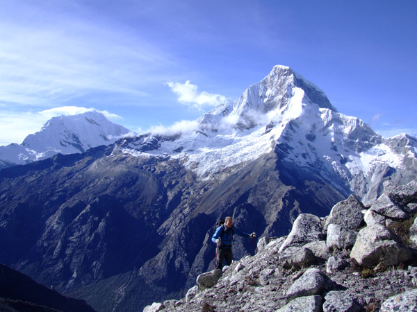
Huascaran as seen from high on Pisco.
Many of the higher peaks also make great ascents, from moderate mountaineering to challenging climbs at the cutting edge of what is achievable. For details of climbs in the Cordillera Blanca see our guidebook 'The Andes - A Guide for Climbers and Skiers'
The Cordillera Huayhuash
The other notable range in northern Peru is the Cordillera Huayhuash, a small but spectacular group of mountains lying south of the Cordillera Blanca and normally reached from the village of Chiquian. It is also possible to access the mountains from Cajatambo. The big peaks of the Huayhuash are all extremely difficult ascents - Yerupajá 6617m is the highest and a very difficult ascent. It was on the neighbouring peak of Siula Grande that Joe Simpson had his epic fall into a crevasse, so vividly written about in 'Touching the Void'.
The circuit trek of the Cordillera Huayhuash is well known as one of the world's greatest high-altitude treks. It crosses six passes over 4500m high and covers a total of 150km. The trek takes from ten to sixteen days. From all the passes there are spectacular views of the Huayhuash mountains and in the lower valleys that you trek through there are many small lochs and beautiful campsites. The local Quechua Indians who still live and work in these valleys are always keen to catch fresh trout to sell to trekkers The trek also passes through a number of their remote villages and you can even (occasionally) buy a beer !
Village in the Cordillera Huayhuash
The start and finish of the normal circuit trek is normally at Chiquian which is easily reached by bus from Lima or Huaraz. The town has a a few basic restaurants and hotels and it is easy to arrange a local arriero and some donkeys to take you round the circuit. Mountain food is perhaps better bought in Huaraz or even Lima. Other treks are possible starting from Cajatambo, or walking form Chiquian to Cajatambo. ANDES run a Huayhuash Trek most years.
Cuzco, Machu Picchu and the Cordillera Vilcanota
In southern Peru the area round the city of Cuzco offers a wealth of opportunities for adventure travel. The Cordilleras Vilcanota, Vilcabamba and Urubamba nearby all offer superb trekking. Further east in the lowland area of Cuzco province around the town of Puerto Maldonado are some of the most accessible parts of the Amazon rain forest.
Cuzco, the old capital of the Inca empire is in itself a fascinating cultural destination. Many ruins from the days before the Spanish conquest of Peru are still visible in the city and surrounding foothills. There are countless examples of the Incas incredible skill as stonemasons. Huge granite blocks fit so well that a knife cannot be inserted between them. The most famous ruins are those at Machu Picchu. There are also some beautiful buildings in the city built by the early Spanish colonists, including the cathedral.
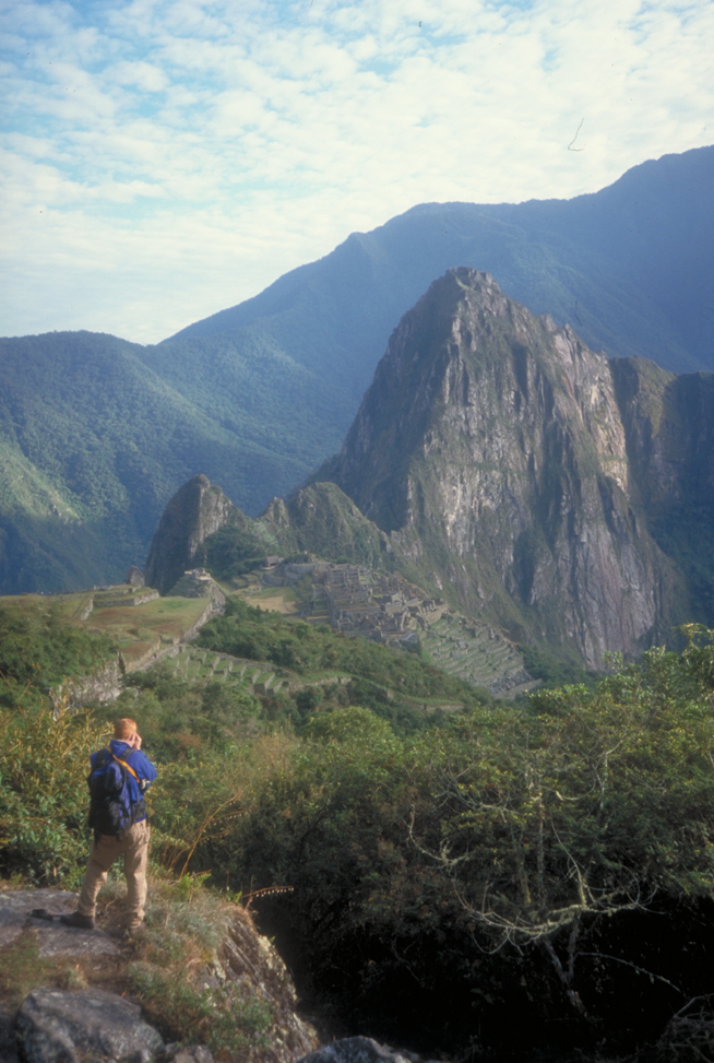
The classic view of Machu Picchu
Because the city lies at an altitude of 3500m its wise to spend a couple of days in Cuzco when you first arrive from sea level, getting used to the altitude. This is a great chance to explore many of the ruins in and around the city, including the Temple of the Sun and the magnificent fortress of Sacsayhuaman which sits on a hillside overlooking the city.
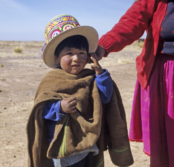
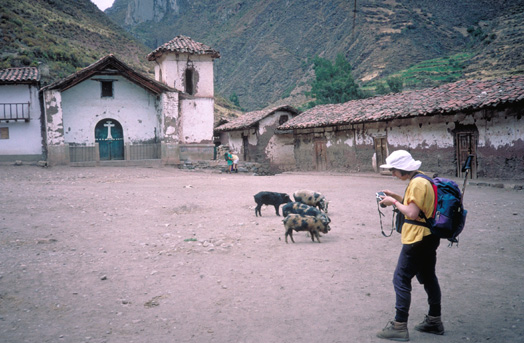
Wee boy in the Cordillera Carabaya.
One of the best high mountain treks in Southern Peru is the circuit trek of Ausangate in the Cordillera Vilcanota. The Cordillera Vilcanota are a compact mountain range situated about 200km southeast of Cuzco. They are perhaps the most rugged and are certainly the most remote mountains in Peru. The range contains several peaks over 6000m - you get spectacular views of them from many sides if you do the circuit trek round Ausangate. This is a relatively hard and wild trek, the highest regularly done in the Andes, with many camps above 4600m and two passes of over 5100m. There are some idyllic campsites in the valleys, several beside natural hot springs. Most of these valleys are still used as pastures by the Quechua speaking Indians and this is the best place in Peru to see llamas and alpacas grazing. It is also a good area to see some of the exotic wildlife of the Andes including vicuñas, vizcachas, humming birds and the wonderful condor. The basic trek takes from five to seven days but if you have time there are numerous longer possibilities in the very remote southern section of the Vilcanota mountains.
The normal start and finish of the trek is in the small village of Tinqui on the northern edge of the Vilcanota mountains. Horses can be arranged here and there are two very basic bunkhouses. We have previously run many scheduled treks featuring the Ausangate circuit.
There are numerous other treks in the Cuzco area with some particularly good ones in the Vilcabamba mountains around Salcantay and Pumasillo.
Arequipa and the Colca Canyon
In south west Peru the volcanic Cordillera Occidental around Arequipa are notable for easy ascents including El Misti and Chachani and also for the spectacular walk through the Colca canyon.
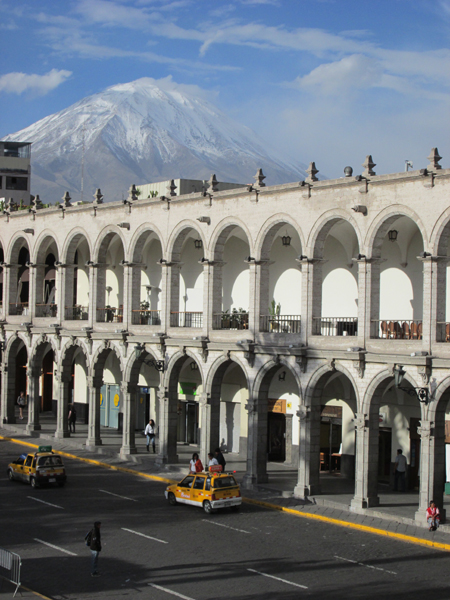
Volcan Misti, above Arequipa seen form the Plaza de Armas
The perfect cone of El Misti 5822m towers over the main square of Arequipa. Sometimes there is a little snow on the summit, but usually it is completely dry. Hundreds of people make the tiring ascent to the summit every year and the mountain is suitable for people with no mountaineering experience. The normal route is on the north side from the reservoir at Aguada Blanca in 2-3 days. If you want to reach the elusive figure of 6000m then the nearby peak of Chachani 6075m is an ascent nearly as easy as Misti, though often requiring the use of an ice-axe and crampons. Tougher and more remote peaks include Coropuna and Ampato. Information and transport to these mountains is readily available in Arequipa.
The best hiking in this area is undoubtedly in the Colca Canyon which has become famous as the world's deepest canyon. This is also one of the best places in the Andes to see condors. Strenuous hikes of from 2 to 6 days start near the town of Chivay, which is a dusty eight hour bus ride from Arequipa.
Peru Factfile
When to go - The dry season in Peru is from May-October with May, June and July normally being the best months. The Cordillera Occidental and area around Arequipa and the Colca Canyon are dry enough all year except December-March
Weather - Expect lots of clear dry days in June, July and August, but with occasional storms which will fall as snow in the mountains. Cold and usually frosty nights once you are above 3000m altitude.
Flights - Flights to Lima from London cost approximately £600. From Lima there are flights to the southern cities of Arequipa, Puno (Juliaca airport) and Cuzco for about £300 return.
Guidebooks - 'The Andes - A Guide for Climbers and Skiers' by John Biggar, details ascents of many of the peaks mentioned.
